ORBIT Voyager:
Implementation of spatial data - visualization using Google Maps/Google Earth
-
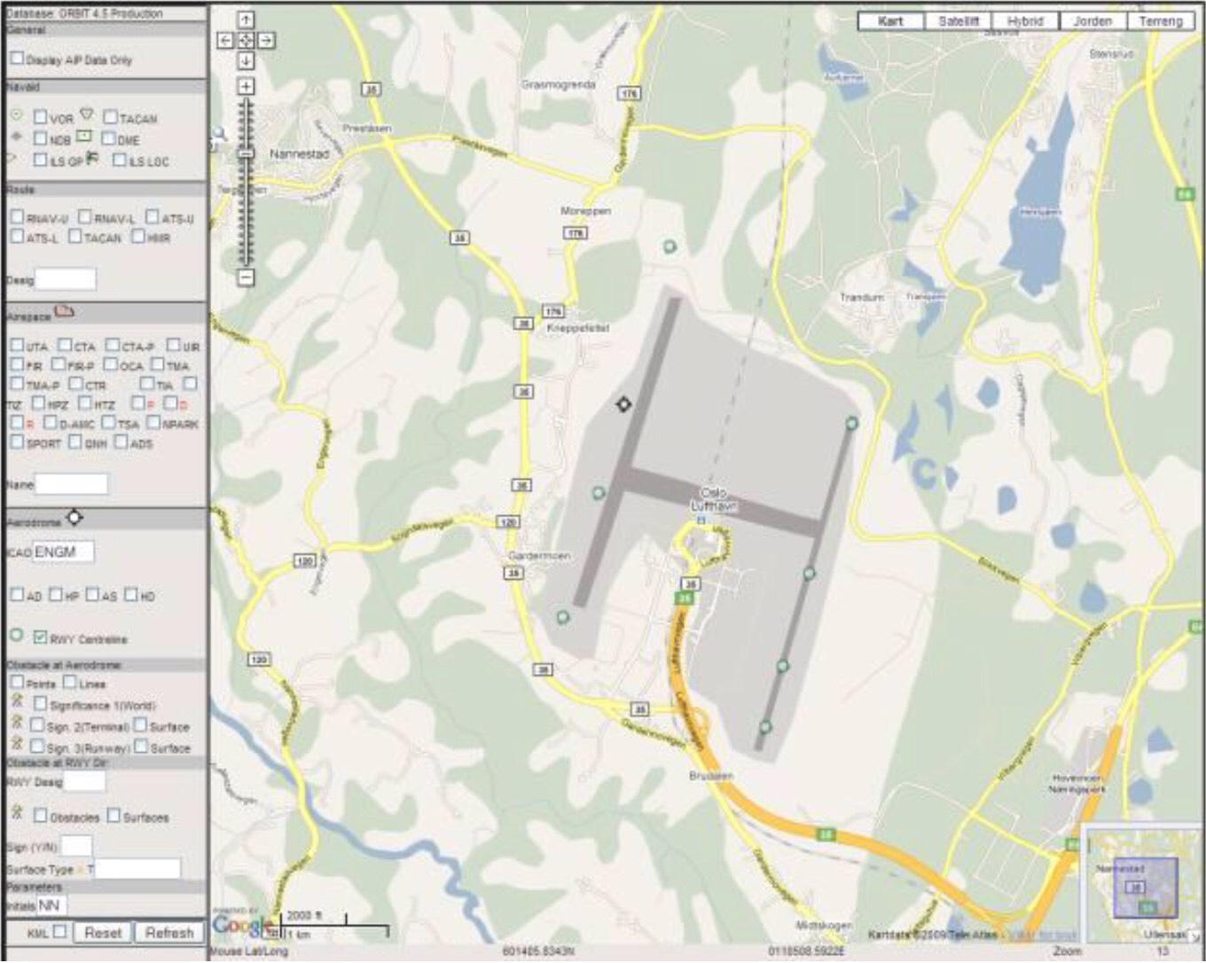
![]()
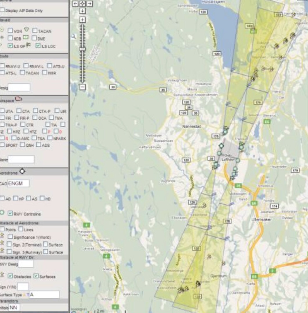
ENGM Gardermoen and runway centreline points are displayed as symbols. By clickingthe symbols, detailed properties as displayed in an overlay window
-

![]()
ENGM Gardermoen and runway centreline points are displayed as symbols. By clickingthe symbols, detailed properties as displayed on an overlay window
-
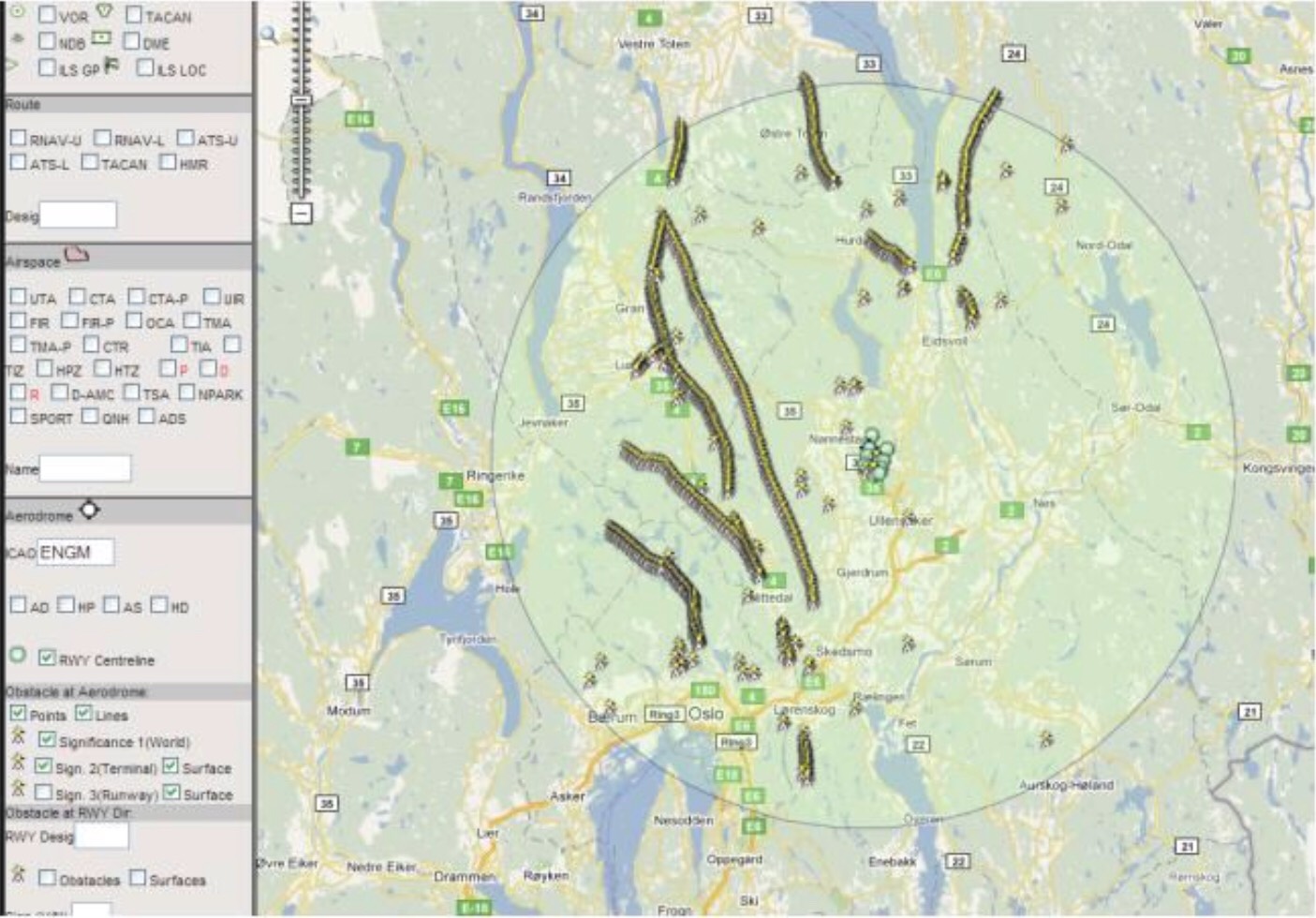
![]()
The picture displays obstacles surrounding Gardermoen, possibly significant for aeronauthical activities. A 45 km circle around the airport indicate area where special significance rulesapply.
-
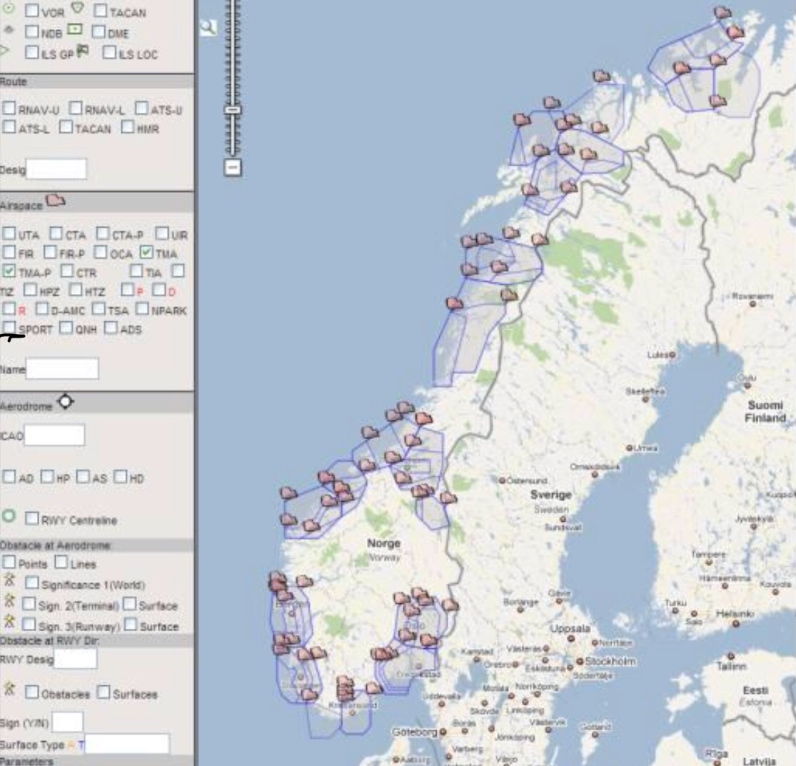
![]()
TMA airspaces in Norway
-
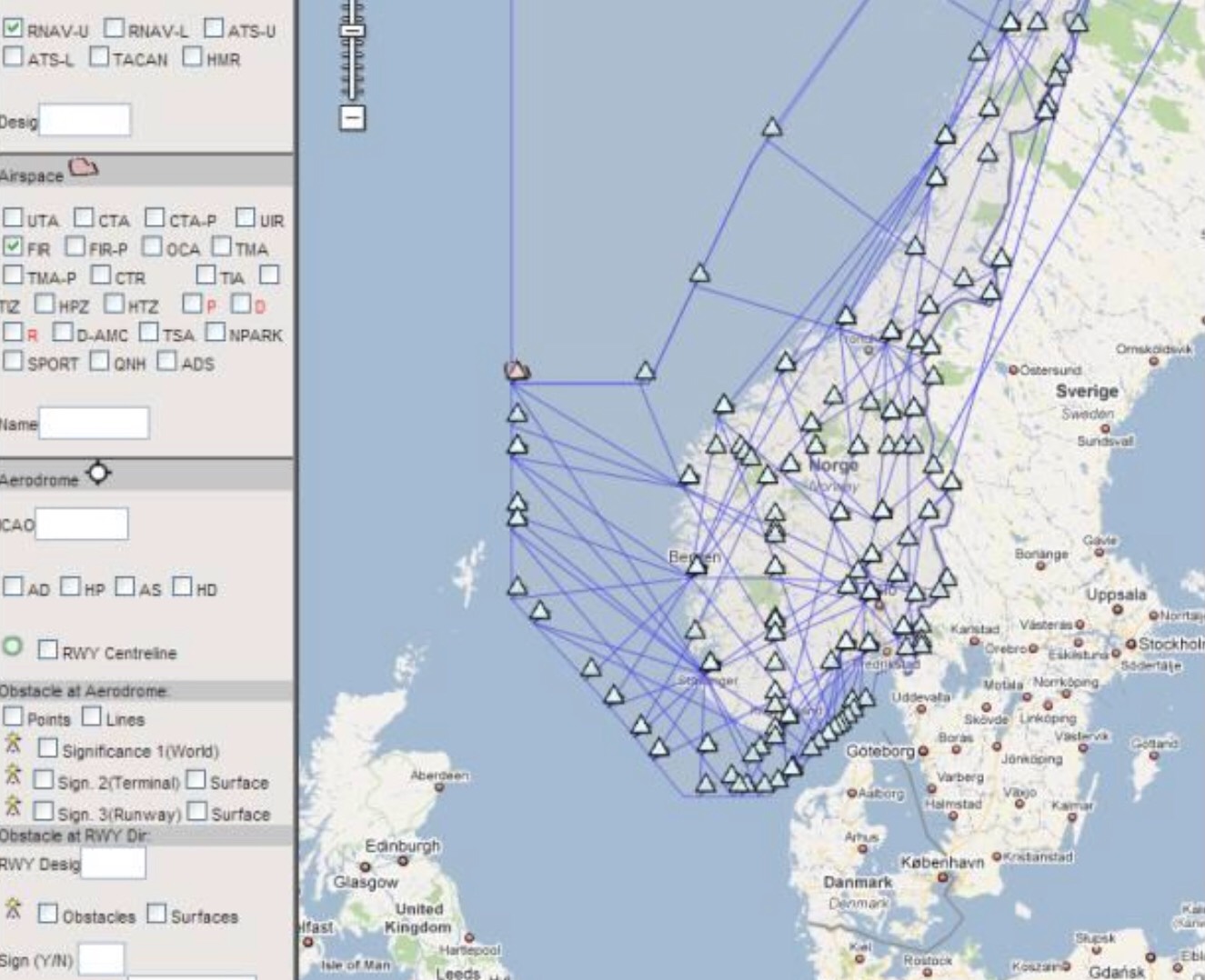
![]()
FIR airspaces and RNAV Upper routes are displayed
-
![]()
The image displays approach areas for Gardermoen, and obstacles in these areas.
-
![]()
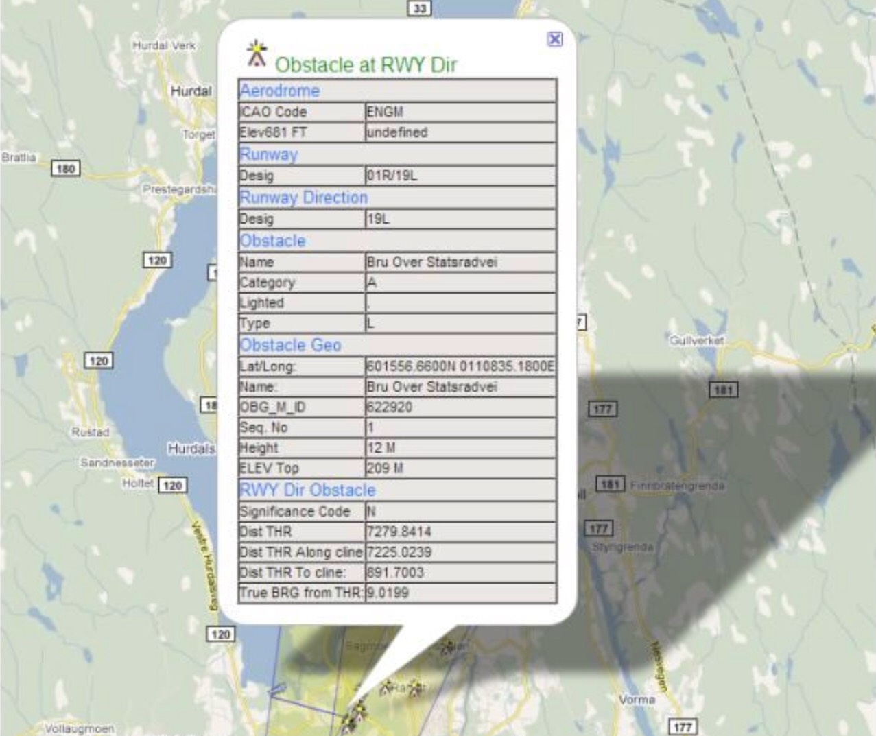
By clicking one of the displayed symbols detailed information for the object is displayed.
-
![]()
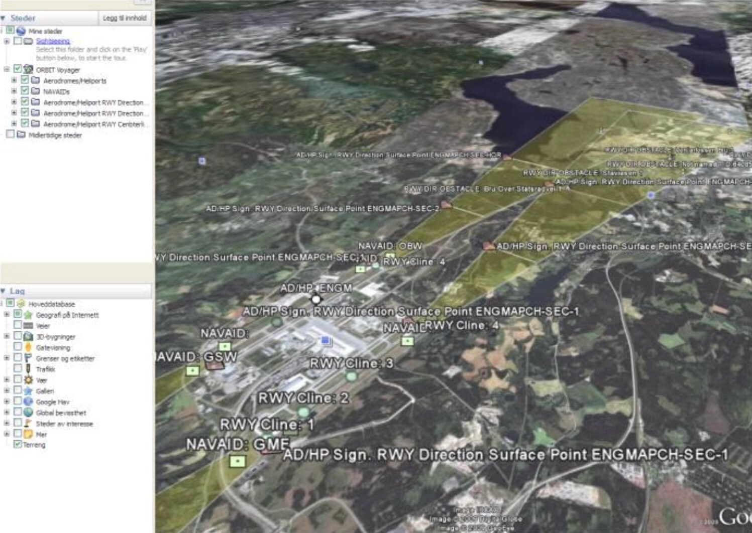
The selections made in Voyager can be exported to Google Earth. Here approach surfaces and obstacles
-
![]()
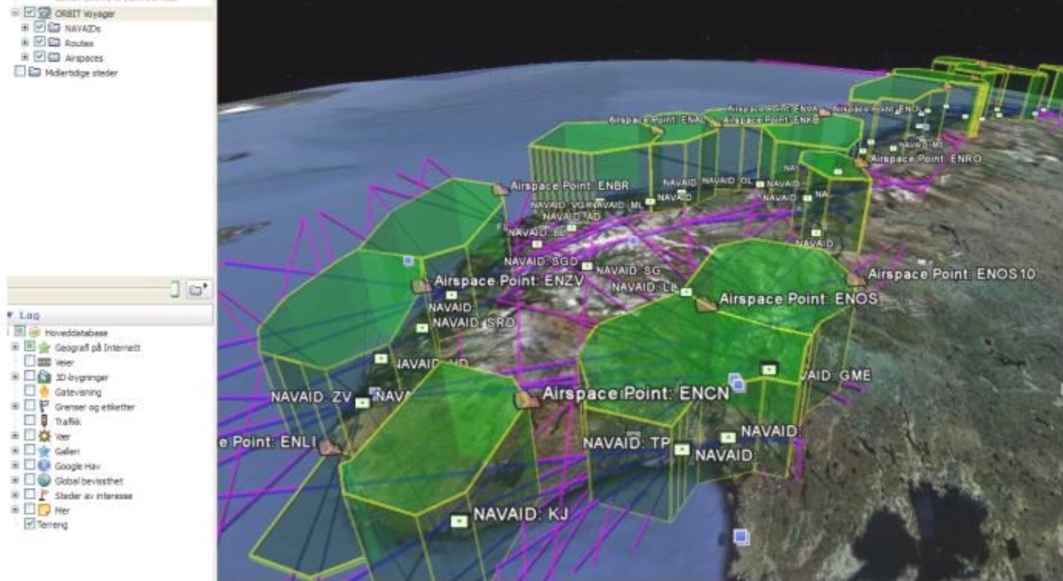
TMA Airspaces and RNAV Upper routes displayed in Google Earth with correct elevation
-
![]()
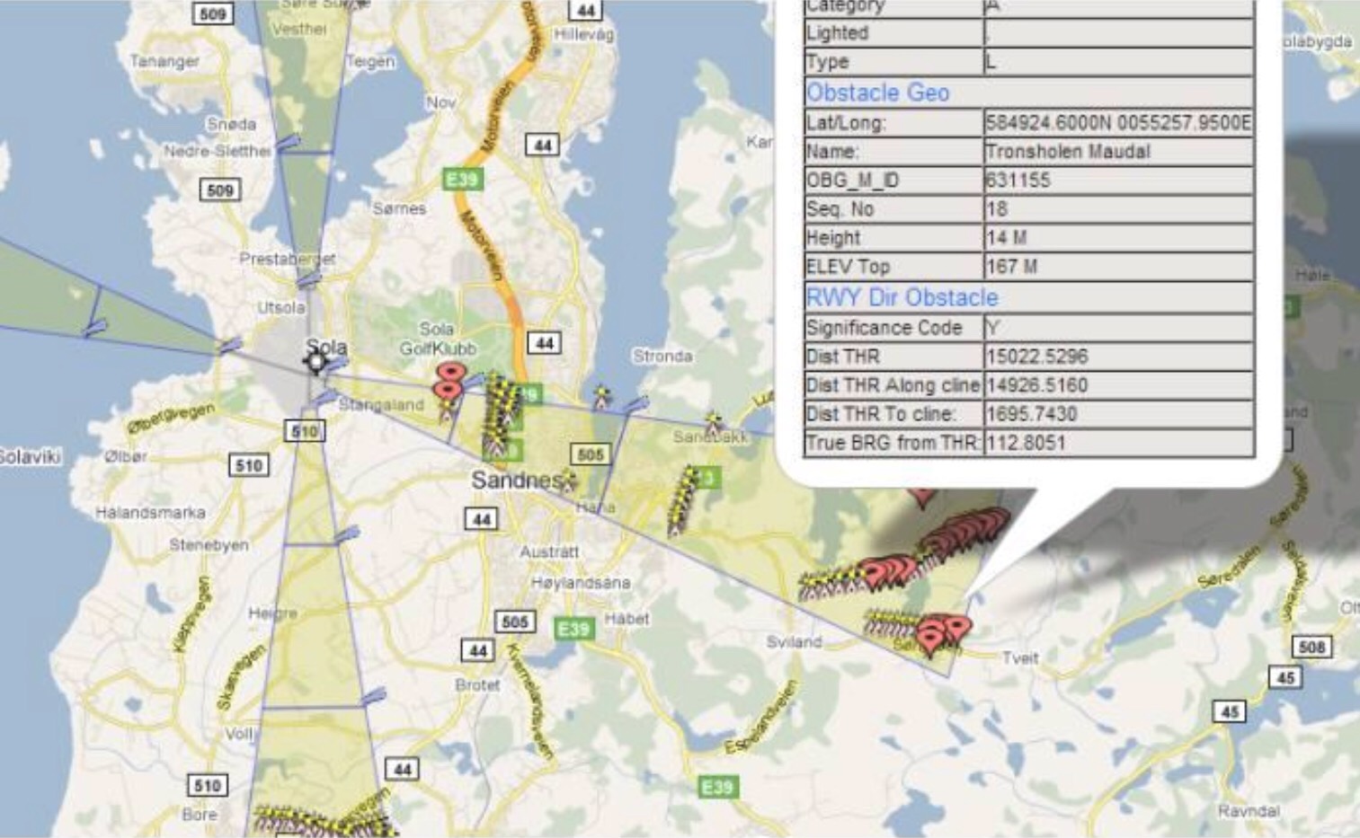
The picture shows approach area from east towards Sola, and significant obstacles in this area
-
![]()
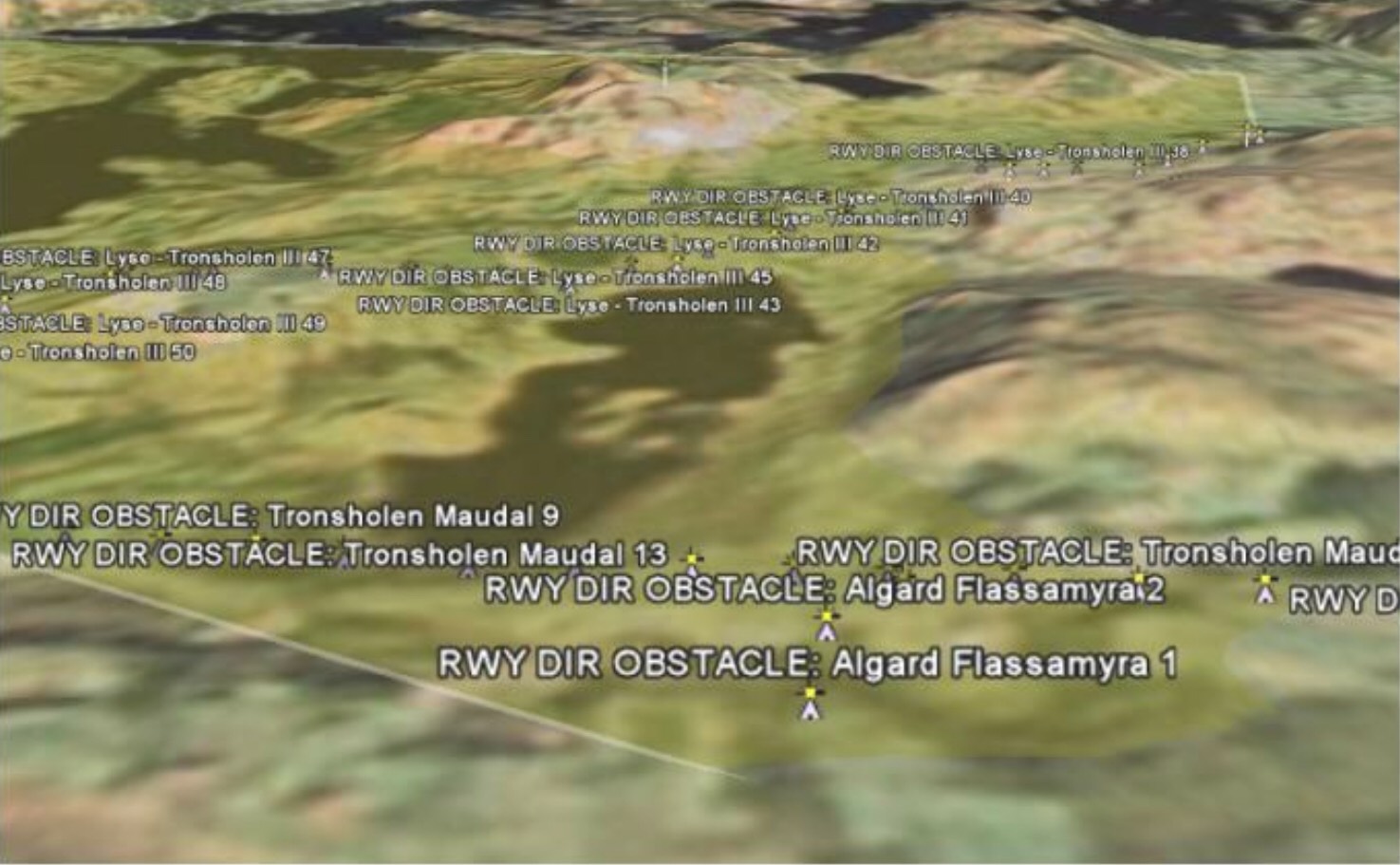
The same data displayed in Google Earth. Obstacles are placed with correct elevation and a pin down to earth to visualize obstacle height.


Avinor's Aeronanutical Database - ORBIT - contains mostly positioned data. To perform spatial calculations in the database, the data is stored as spatial objects. This allows the use of Oracle Spatial's spatial functions for queries like:
- Find all obstacles within a radius of 45 km from an airport
- Find crossing routes in airspace
- Find distance and direction
- Construct airspaces
- Find potential obstacles in aerorome or runway areas
BAIT has assisted Avinor in developing this functionality.
To visualize spatiale data, we have developed web-based user Interfaces based on Google Maps. Positioned aeronautic data in Avinor's aeronautical databse can be cisualized using Google Maps. We have integrated this Web-based map engine with Oracle, and built a user interface to select data to present on the map. Google's map engine provide acceptable map quality, and possibilities to attach client data, text, symbols, lines etc. and at the same time zoom/pan on the map and supply with detailed information for each object.
The data can also be shown in 3D using Google Earth. This program can in addition with map data show a selected area with aim and direction: Google Earth integrates terrain models with maps providing terrain elevation views.
Development tools/technology:
- Oracle DB
- Oracle Spatial
- Java
- PL/Sql
- XML
Customer:
Avinor